MASSACHUSETTS
I wanna tell you ‘bout the town of Stockbridge, Massachusetts, where this is happenin’. They got three stop signs, two police officers, and one police car, but when we got to the scene of the crime, there was five police officers and three police cars, bein’ the biggest crime of the last fifty years and everybody wanted to get in the newspaper story about it.
—Arlo Guthrie, Alice’s Restaurant
Feel I’m goin’ back to Massachusetts.
Something’s telling me I must go home.
And the lights all went out in Massachusetts
The day I left her standing on her own.
—Bee Gees, Massachusetts
Well I am older now,
I know the rise and gradual fall of a daily victory
And I still write to my senator saying they should legalize cannabis,
And I should know
‘Cause I am a horticulturist,
I have a husband and three children out in Lexington, Mass.
—Dar Williams
The Pointless, Yet Poignant, Crisis of a Coed
Religion
Religion of all denominations strongly dictates American culture and societies, more in some states than in others. Utah is known for its Mormons, North Dakota has a decidedly Lutheran bent, Alabama and Mississippi give us Southern Baptists, and Massachusetts is equally identified for its marked Catholic roots. To be fair, the association extends most acutely within the city limits of Boston, but as the dominant city of the state, the link to Catholicism radiates outward. Historically speaking, this religious association could scarcely be more ironic. The Puritans and Pilgrims who first settled the coast of New England were Protestants escaping the oppression of the Catholic monarchy in England. Yet modern-day Massachusetts supports a Catholic population that is nearly double that of its Protestant population—the result mainly of immigration from predominantly Catholic places such as Ireland, Italy, Poland, and Puerto Rico. Both historically and currently, Massachusetts proves to be a stronghold of religious influence.
When denizens of the Commonwealth of Massachusetts weren’t concerning themselves with religious matters, they may have been busy explaining to the rest of the country how they themselves preferred to be named. People from Boston are cleverly known as “Bostonians,” but for Massachusetts residents who live outside the city limits, the conversion from state-name to resident-name is a little less clear. Officially, we should be calling them “Bay Staters,” a term that seems obvious enough considering we’re talking about The Bay State, founded on Massachusetts Bay. But this designation feels like something of a cop-out. After all, even Illinois gets away with Illinoisans!
But Massachusetts simply refuses to follow the rules, rather than finding an appropriate suffix for the 13 letter-long state name—Massachusetts shares the title of the longest name with both of the Carolinas—yet we can be assured that someone, somewhere, possibly at Harvard, has tried. Massachussians?
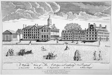
Harvard. Including "University of" is simply unnecessary. Founded in 1636, the oldest higher learning organization in the country and member of the prestigious Ivy League, Harvard is undoubtedly one of the most famous institutions in the United States. Its austere history dates back farther than most states have existed. It serves as an American emblem for original theories and ideas—the very basis upon which America was founded.
Captain John Smith
If you want to learn more about the name Massachusetts a good place to start is with the history of Virginia, because the person responsible for first placing the word Massachusetts on European maps was Captain John Smith—the same John Smith of Jamestown fame, Pocahontas fame and Virginia fame. While Smith belongs indelibly to the history of Virginia, his mark on New England, while perhaps not as famous, is at least as heroic—in fact, almost superhuman.
In 1614, after having recovered from a gun-powder accident that forced his departure from Jamestown, Smith was hired by the Northern Virginia Company to explore the coast of the northern section of the continent, very near where the French were already establishing themselves. Smith explored the coastline from Nova Scotia to Rhode Island, providing his employers and potential colonists with the first description of this land, which he named “New England.” However, when Smith attempted to return to New England he was captured by French pirates and kept prisoner on their ship for several months. Ever industrious, Smith used his time in captivity to write “A Description of New England” which he was able to keep with him when he escaped the pirates during a storm and made his way safely to the European mainland. When he got back to England he published the book, and it became a smashing success.
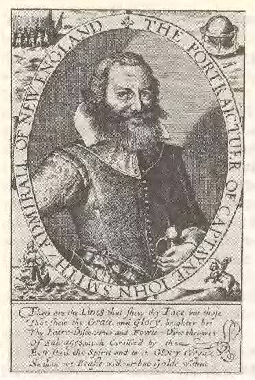
Smith’s first mention of the word “Massachusets” was in reference to the people of that tribe, and was not remarkable, “...The others are called Massachusets,” he wrote simply, “of another language, humor, and condition.” But later he writes of the land occupied by this tribe with glowing praise, “...And then the Countrie of Massachusets (sic), which is the Paradise of all those parts.”1 He goes on to describe the fertility of the land, the agreeable coastline, and the friendly but valiant natives.
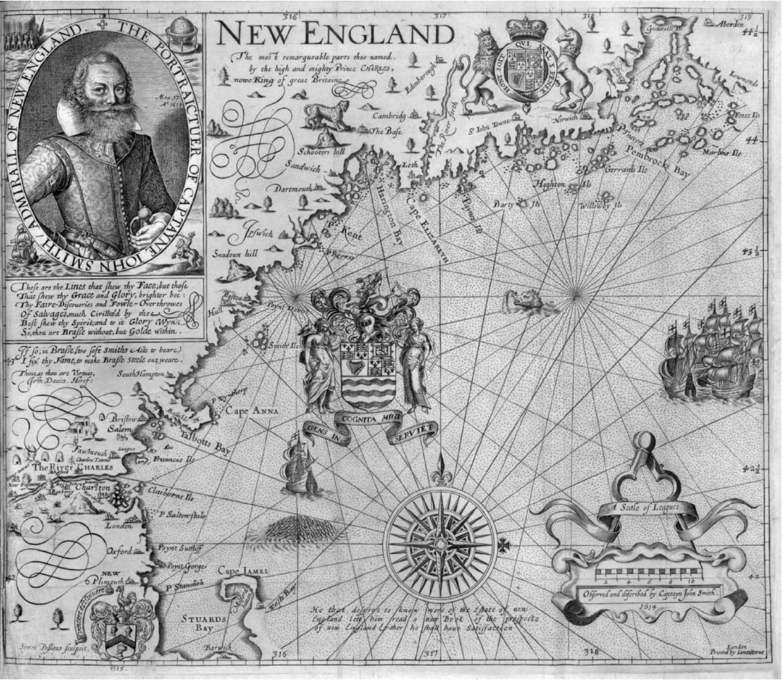
When he presented his book and accompanying map to his benefactor, Prince Charles, Smith requested that His Highness “please to change their barbarous names for such English....”2 The Prince obliged, and covered the map with names taken from his own realm and his own family. Fortunately Smith provided a legend, correlating the native names with their replacements, or as he puts it, the “old names” with the “new names.” Among the other names on the list Smith tells us that Massachusetts Mount corresponds to Cheviot Hills and that the Massachusetts River is now the Charles River . In hindsight, Charles might need not have bothered. Of the list of “new” names, only three remain today: The River Charles , Cape Ann (named for Charles’ mother), and Plymouth .
The Massachusetts Indians
The name “Massachusetts” is Algonquin meaning “at the range of hills” or “people of the great hills.” It described the Indians who lived in the area of Massachusetts Bay around 1614 when Smith visited. The hills referred to are the Eastern Upland section of the state, which extends along the coast and inland forty to sixty miles, and is an extension of the White Mountains of New Hampshire. Some historians actually name the precise hill to which “Massachusetts” refers—the Great Blue Hill—in Milton3. While it is debatable whether the word referred to that or any particular hill, it is certain that The Great Blue Hill of Milton was at one time inhabited by Massachusetts Indians.
There is, however, no longer a Massachusetts tribe, nor has there been for hundreds of years. Unfortunately, within three years of Smith’s exploration the Massachusetts Indians who inhabited and gave their name to the bay area, were nearly eradicated by disease. Generally believed to have been Bubonic Plague, the pestilence ripped through the coastal natives at about a 75 percent mortality rate. To make matters worse, the now weakened and vulnerable people were attacked by rival tribes from the north, virtually wiping out the Massachusetts Indians completely. Those who survived were forced to move elsewhere and ally themselves with neighboring tribes.
The villages they left behind were ghost towns, strewn with the bones of unburied bodies. The fields of corn and squash that they had cultivated were completely abandoned. These were the villages which the Pilgrims found when they arrived in 1620, and into which they moved, relieving them of some of the effort of clearing fields and establishing a township. The Pilgrims called their new settlement Plymouth because that’s what it said on the map—the map on which John Smith had removed all the native names and had them replaced with more palatable English ones. But the settlers traded with the Indians and soon returned to many of the native names out of necessity of communication. They were familiar, too, with the name “Massachusetts” because while Smith had changed his map, his book had been a best seller, and had, after all, described Massachusetts as a “paradise.” And so, once Plymouth was established and new colonizing efforts were developing back in England, Massachusetts became a logical place for charter companies to choose to place their colonies.
The Massachusetts Bay Colony
One such company was the Dorchester Company of Adventurers, whose driving force was a Puritan Minister named John White. White was concerned about poverty among the fishermen in his community, and was in agreement with John Smith about the potential solution—colonization in the New World, particularly in New England where the fishing was good. Unlike the Pilgrims of the Mayflower who were religious separatists and whose discontent with the Church of England was complete, the Dorchester company was a
“company of puritans; but not a puritanic company...a group of public-spirited men who wished to do something for their country, a little for the Indians, somewhat for the fisherman, and a great deal for themselves.”4
In 1623 the Dorchester Company financed a fishing settlement on Cape Ann called Stage Fort Point. It was a miserable failure but taught the adventurers something about colonization, most notably not to expect fishermen to farm and maintain a plantation. A handful of the fishermen, however, including a man named Roger Conant, stayed in New England and built a few thatched houses at a place the natives called Naumkeag. The winters were harsh, and they considered moving south to join the colonies in Virginia, but instead they persevered and awaited word from John White.
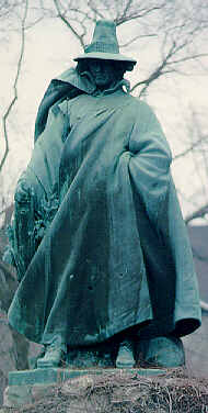
White, in the meantime, had reorganized the Dorchester Company into “The New England Company for a Plantation in Massachusetts Bay,” and the name says it all. With new funding and new leadership, the goals of John White and the investors had changed from underwriting a fishing village to organizing a much more ambitious colony, and they had chosen the place. On March 19, 1628 a patent was granted for
“‘all that parte of Newe England in America’ lying between parallels three miles north of ‘a greate river there, commonlie called Monomack, alias Merriemack,’ and three miles south of ‘a certen other river there, called Charles river, being in the bottome of a certayne bay there, commonlie called Massachusetts, alias Mattachusetts, alias Massatusetts Bay...from the Atlantick and westerne sea and ocean on the east parte, to the South sea on the west parte.’”5
On this patent the rivers used to define the borders were perhaps ill-chosen because of their winding nature, but the only map available (John Smith’s) showed only their mouths, and they seemed reasonable enough landmarks at the time. The year after this patent was granted, the colony obtained a Royal charter for the Massachusetts Bay Company, and the village of Naumkeag, where Conant and a few other hardy folk were still living, was officially renamed “Salem”—derived from a Hebrew word meaning “peaceful.” In 1630 the town of Boston was founded and very shortly thereafter made the seat of colonial government, but the name “Massachusetts Bay Colony” continued to refer to the villages of Boston, Salem, and new puritan settlements in the area founded under the Massachusetts Bay Company charter.
While the colony at Plymouth had survived for ten years it had not exactly prospered. Its population at the time of the founding of the Bay Colony was probably around 500 and constituted the primary concentration of English people in New England. That would all change abruptly with the “Great Migration” of the 1630s. In that decade the immigration of people—mostly English and mostly Puritan—to the Massachusetts Bay Colony would grow to around 20,000, and the town of Boston would be surrounded by new villages, perhaps the first suburbs of the New World.
Drawing the Boundaries
In 1678 the General Court of Massachusetts purchased the province of Maine (a province they had controlled for two decades) from the descendants of the patent holder, Sir Ferdinando Gorges. This pushed the northern boundary of the Colony into present-day Maine, but the southern boundary was still the Charles River. Then, the following year the province of New Hampshire, which had also been governed from Boston for several decades, was divided from Massachusetts and made a separate royal province. This physically separated the Province of Maine from its “mother” province of Massachusetts.
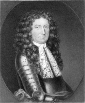
In 1684 the Royal Charter of the Massachusetts Bay Colony was revoked by King Charles II, who resented the independence of the New England colonies. His successor, the unpopular King James II, attempted to unite the English colonies in New England as well as New York and New Jersey under the auspices of the Dominion of New England with an appointed governor, the tyrannical Sir Edmund Andros. Andros’ governorship ended with his arrest and imprisonment after the English throne was wrested from the Stuart monarchs and the reign of William and Mary began in 1688.
In 1691 a new charter united Plymouth with Massachusetts and officially added the province of Maine. On February 6th, 1788 Massachusetts became the sixth state of the Union by ratifying the Constitution. Not until 1820 would Maine be severed from Massachusetts and admitted to the Union separately.
End Notes
1. Arber, Edward (ed.), “The Travels and Works of Captain John Smith,” Burt Franklin: Research and Source Works Series #130 , (Edinburgh, 1910) pp. 192-205.
2. Arber, p. 699.
3. Morison, Samuel Eliot, Builders of the Bay Colony , (Boston, 1930) p. 10.
4. Morison, p. 28.
5. Morison, p. 32.